
Cultural activity
January 20th, 2024
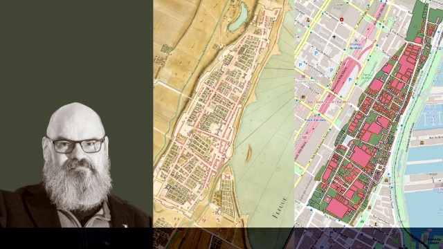
Lecture | Retrieving and enriching map data thirty years after “Opening the Gates of Eighteenth-Century Montréal”
Saturday, January 20, 2024
2 pm
Youville Pumping Station
173 Place D’Youville
Lecturer: Léon Robichaud
Free for members of the Société historique de Montréal, $5 for non-members
No reservation required
Learn how technological advances have allowed Montréal map data to be updated, providing a deeper understanding of the evolution of the city’s urban environment.
This lecture is presented by the Société historique de Montréal.
The celebration of the 350th anniversary of the founding of Montréal in 1992 left behind a rich legacy for historians. Created as part of the exhibition Opening the Gates of Eighteenth-Century Montréal and put online in 1996, the Adhémar database consolidates information on the urban environment, such as plans, as well as data on buildings and the population. Through funding from the Laboratoire d’histoire et de patrimoine de Montréal and technological advances in geographic information systems (GIS), data that was once just textual can now be made visible on interactive maps.
Delve into this fascinating world with Professor Léon Robichaud, who will tell you more about these geographic systems and their applications, which allow for a better understanding of Montréal’s urban setting and for various types of research into the world of the past.
Not to be missed!
Léon Robichaud
Léon Robichaud is a professor in the Department of History at Université de Sherbrooke, publication director of the Revue d’histoire de l’Amérique française, and co-director of the Laboratoire d’histoire et de patrimoine de Montréal. Specializing in the social history of politicians in New France and in digital humanities, he is interested in the relationships between inhabitants and authorities, as well as the use of geographic information systems in analyzing social phenomena.